Details of Current Condition
Site Information
Administrative Boundaries
The selected area is located in with an approximate area of hectares.
Forest Cover, Protected area and Land Use Concession
The selected area has forest coverage of 0% of total project area. From the total area, 0% is designated as Protected Area
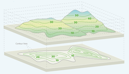
Elevation
The topography of the area consists of :

Land Cover
The major land cover categories in the selected area are:

Peatland/Mangrove
Historical Deforestation
Deforestation in this project area in the past 10 years is driven by
This project location has experienced forest loss of up to ha in the past 10 years, with the annual historical rate of deforestation of 0%
Deforestation Risk
Most of the selected area has a - risk of deforestation.

Natural Disaster Risk
The selected area is susceptible to several natural disaster risks, including:
-
of floods
-
of landslides
-
of drought
-
of cyclonic
Nature
Key Biodiversity Area
The selected area is located within Key Biodiversity Area and has overlapped area by .
Forest Landscape Integrity Index (FLII)
The average forest integrity in the regions is:
*[undefined]
Number of Wildlife Species
The selected area hosts a range of wildlife, including:
Amphibi
Species
Bird
Species
Mammal
Species
Reptile
Species
Total Wildlfie Species:
Species
Lives in this area
The Endangered Trees Species:
The project area is home to of endangered trees.


Tiger Conservation Landscape
Your project site has not overlapped with any tiger conservation landscape.
Landscape area of Tiger Conservation Status:
Climate

Annual Temperature
Annual mean temperature in the selected area ranges from to degree Celsius with an average of degree Celsius.
Annual Precipitation
Annual precipitation in the selected area ranges from to mm with an average of mm.
Current Carbon Storage Total
undefined
The area hosts an extensive carbon sinks that currently stores 0, adding to the vital fight against global warming.
Another data source (Walker et al 2022) estimates a total carbon storage of +/- tonnes.
Burned area
Over the past ten years, fires have affected this project location, impacting up to hectares of burned area, with an average frequency occurrences in several areas.
People
Gender Proportion
People (%)
Male
People (%)
Female
Age Group (years old)
10-30
People
31-50
People
>50
People
Social (Demography)
The selected area is located in District of Province which has 0 of people with 0 total number of households that could be impacted by the project. Population density in this district is 0 people/sq km in density with 0%/year of population growth. The province has 0 people have migrated.
Ethnicity

Education
Within the nearest district/city of District/City, have graduated from high schooland hold university degree.
Junior High School Level:
University Degrees Level:
Employment
Within the nearest district/city of District/City, have graduated from high schooland 0 hold university degree.
% of community are unemployed
Job Category
Majority of people in District/City work in the sector:
Water
The annual water yield of the project area and the nearest jurisdiction of District/City are respectively 0 m3. The sources of drinking water in the district or are surface water 0%, ground water 0%, and other 0%.
Source of drinking water
0%
Surface Water
0%
Ground Water
0%
Other
Annual Water Yield
0 m 3
Health
Health Facilities
There are 0 number of health facilities in District/City area,
Medical Workers for 1000 People
The number of medical workers per capita or per 1000 people in this District/City is 0.
Data for Triple-Benefit
Site Information
Land Features
The area is spanning over 0 ha with 0 ha (0%) allocated for avoided deforestation and 0 ha (0%) allocated for ecosystem restoration.
Nature

Area of Habitat
Climate
People
Ecosystem Services
Reducing
0%
potential erosion
Improving
0%
water yield
Environmental Improvement
The project intervention will provide other potential benefits to local people community who live nearby the area:
Select Document Standard
Choose the section you would generate
The document is processing
We will sent your generated template to your email. While waiting a minute, you can explore your previous or running projects on your dashboard.
Export area as Image
Edit the layering orders of activated data spatial on legend control on the right corner of interactive map


Disclaimer:

List of Data Spatial Layer
- No location found
Analyze your current condition data
With this interactive map, users can get insights regarding their interest area, which can be selected by drawing a polygon or uploading a shapefile.
Draw Polygon: Select the location of the area by forming a polygon based on the desired point
Upload SHP: Upload a previously owned SHP format file for specific geofencing areas
Legend
No layers data is selected
Activate your layers filter first
Powered by Esri